Sep 10 2015
By compiling meteorological wind data – derived from several sources – Cornell University and the Technical University of Denmark scientists have assembled the first full observational wind atlas of the Great Lakes. The atlas bolsters the chances for developing wind energy in the region.
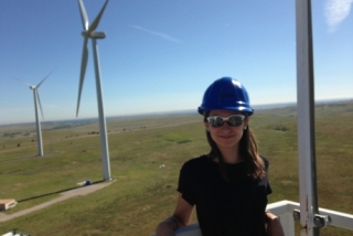
 Cornell's Paula Doubrawa stands atop a wind turbine at the National Renewable Energy Laboratory's Wind Technology Center in Colorado in August, where she was conducting research.
Accurate wind data lives in a disjointed and disjunctive world. The researchers have meshed these data to create a high-definition atlas, using information gathered from weather stations, buoys, QuikSCAT (a NASA satellite that collects wind direction and speed data over water bodies) and satellites equipped with synthetic aperture radar, or SAR.
“The techniques that we have employed optimize the strengths of each measurement type, allowing a longtime series of data to be combined with the exceptional spatial resolution of the satellites – corrected for gaps in data due to ice cover in the winter months – using a new algorithm,” said lead author Paula Doubrawa, a Cornell doctoral candidate in the field of engineering.
Doubrawa, her adviser Rebecca Barthelmie, professor of engineering, and others published, “Satellite winds as a tool for offshore wind resource assessment: The Great Lakes Wind Atlas” in the journal Remote Sensing of Environment (October 2015.)
For years, scientists, economists and environmentalists have touted the potential for wind-energy development in the Great Lakes region, as it features a large expanse of exploitable wind resources. The lakes – touching eight states and two Canadian provinces – extend over 150,000 square miles, creating about 84 percent of North America’s surface freshwater and 21 percent of Earth’s total surface freshwater.
Wind resources are difficult to quantify accurately, Doubrawa said. For example, surface ice formation during winter months precludes retrieval of wind speeds from satellites and warrants removal of buoys. Additionally, offshore observations are sparse, and sometimes wind data derived from satellite scatterometers (microwave radar sensors) and SAR may not be available either in time or at the required location
“The compilation and analysis of these datasets is very time-consuming – and now the work has been done,” said Barthelmie, a faculty fellow in Cornell’s Atkinson Center for a Sustainable Future. “Assembling this atlas and this kind of work helps agencies that plan wind farms or manage where wind farms will be located by identifying optimal locations.”
Said Barthelmie: “These maps can be integrated with other GIS-type databases – for example, mapping shipping lanes or recreational areas – to help plan where wind farms might be located as a balance between wind resource and existing constraints.”
In addition to Barthelmie and Doubrawa, the research is co-authored by Cornell’s Sara C. Pryor, professor of earth and atmospheric sciences; and Charlotte B. Hasager, Merete Badger and Ioanna Karagali of the Technical University of Denmark.
The research was funded by the U.S. Department of Energy, the National Science Foundation and the National Renewable Energy Laboratory.