Jun 3 2021
The Permian Basin is situated in western Texas and southeastern New Mexico. It is one of the major oil- and gas-producing areas in the United States.
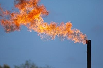
 Researchers have mapped large, intermittent sources of methane emissions (shown flaring here) across the Permian Basin. Image Credit: Leslie Von Pless/Environmental Defense Fund (EDF).
In this region, methane is discharged by oilfield operations, but measuring this greenhouse gas is a hard process due to the vast area and the fact that several sources are intermittent emitters.
At present, scientists have performed a comprehensive airborne campaign with imaging spectrometers and huge methane sources throughout this area. The results have been reported in the Environmental Science & Technology Letters journal from ACS.
The U.S. Energy Information Administration reports that in 2020, 38% of the nation’s total oil and 17% of natural gas production occurred in the Permian Basin. Thus, measuring emissions from such operations, which are still expanding quickly, has gained the attraction of environmental scientists.
Earlier studies have attempted to evaluate methane leakage in the Permian Basin via mobile field studies or satellite images.
However, either the spatial resolution was too coarse to measure methane released from separate sources, or the studies were restricted to small timeframes or areas.
A collaboration was forged by Daniel Cusworth and colleagues from the NASA Jet Propulsion Laboratory, the University of Arizona, and Arizona State University.
The researchers desired to measure powerful methane point source emissions (above 22 to 44 pounds of methane per hour) in the Permian Basin with the help of airborne imaging spectrometry—a technology that would enable high-resolution mapping of such sources throughout huge areas and several overflights.
Between September and November 2019, the team took repeated flights in airplanes carrying imaging spectrometers and covered around 21,000 square miles and 60,000 active wells in the Permian Basin.
The spectrometers could detect 1,100 exclusive huge methane point sources sampled at least three times. A majority of these sources were highly irregular (detected 25% or less of the times sampled).
But regularly constant sources (detected 50% to 100% of the time) contained 11% of the methane emitters but 29% of the entire detected emissions, probably denoting leaking equipment that must be repaired.
Half of the methane detected was released from oil and gas production wells, 12% from processing plants, and 38% from pipelines and other equipment that gather and transport oil and gas.
According to the researchers, the findings indicate that regular, high-resolution tracking is essential to comprehend intermittent methane emitters throughout huge areas and to locate constant leaks for mitigation.
The researchers acknowledge financial support from NASA, the University of Arizona, Carbon Mapper Inc., and the High Tide Foundation.
Journal Reference:
Cusworth, D. H., et al. (2021) Intermittency of Large Methane Emitters in the Permian Basin. Environmental Science & Technology Letters. doi.org/10.1021/acs.estlett.1c00173.