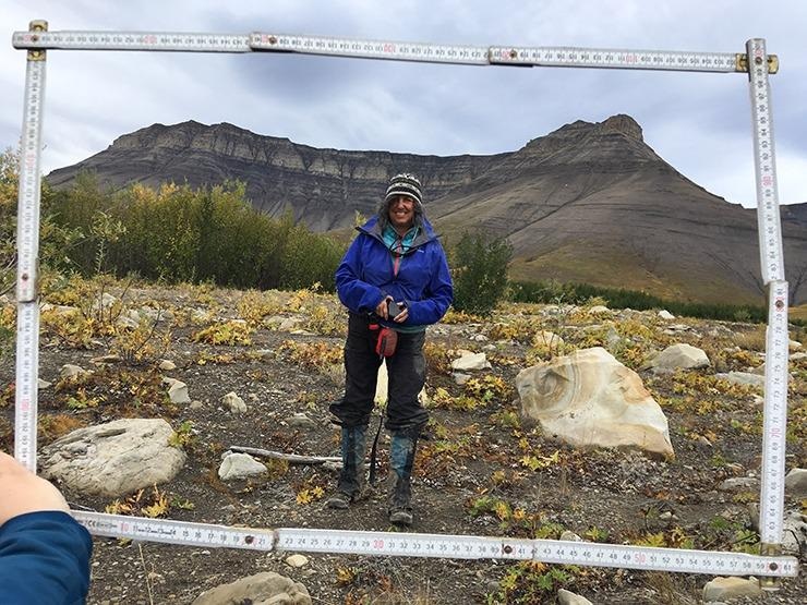
A research team received financial support worth more than $256,000 from the National Science Foundation to study the impact of climate change on Arctic watersheds in the Aklavik Range of the Northwest Territories in Canada.
 Jill Marshall onsite in Akalvik Range. Image Credit: Emma Menio.
Assistant professor of geosciences, Jill Marshall, and Assistant professors of earth sciences, Marisa Palucis and Justin Strauss, all from Dartmouth University will be the investigators of the research. The interdisciplinary team will determine the potential for climate change to drive the transfer of sediments from mountain regions to hillslopes and rivers, along with its impact on the local Gwich’in communities.
Previously really cold rock at a temperature of 26 °F to 33 °F will spend an increased amount of time in the “frost cracking window”, corresponding to the rising temperature. Hypothetically, this results in the amplified rates of rock weathering and sediments production.
The duration and magnitude of permafrost thaw are already increasing due to the warmer temperature, this is a factor that the team indicates will lead to a transition from sediment that creeps and flows downhill to more rapid and voluminous debris flows. The rising rates across Arctic watersheds can affect the ecosystem and the communities due to the high occurrence potential of landslides and the increased sediment supply to alter river habitat.
The research aims to:
- Carry out fieldwork to recognize the way in which site conditions control the rates of frost-driven sediment production, including the process by which the sediments get transferred across this vulnerable landscape
- Integrating multiple analytical tools, which include rare isotopes that can determine the pace of transport over days to months and erosion over millennia using physics experiments with the aim of enhancing the understanding of how ice changes solid rocks into sediments
- Employ remote sensing techniques to extend local findings to the broader Aklavik Range region over the last several decades
- Utilize acquired data to calibrate sediment production and transport model to predict the response of Arctic landscapes to continuing anthropogenic, or man-made, warming scenarios
Researcher Marshall noticed the remoteness of the two field sites, one north of the 68th parallel and the other situated inside the Arctic Circle on the traditional land of the Gwich’in, a First Nations people.
The team receives support from the local community, thus benefiting the research. The fieldwork is highly influenced by the seasons, where either the Mackenzie River freezes and turns into an ice highway or poses a scenario when the location must be accessed by boat or a helicopter.
To identify the sediment transport, the ideal time to visit the sites is when the permafrost is transitioning from completely frozen to active transport, which occurs usually in April. However, climate change has made it unpredictable to determine the ice or water transport routes.
Regarding the objective of the project, Marshall said, “quantify the rate at which the landscape is cracking, breaking apart and moving so we can develop predictive landscape models. This way we can anticipate future impacts and identify areas of greatest concern.”
The researchers will work alongside the Gwich’in community members to collect field and historical data, including oral histories of the region. The team will create and share ArcGIS StoryMaps to promote STEM education with the younger generation of Gwich’in and U.S. undergraduates.
These StoryMaps will be generated in courses provided at Dartmouth College and the U of A (“Virtual Arctic Landscapes”). The maps would enable undergraduates at both institutions to experience the Arctic in an accessible and meaningful manner.