May 25 2015
Ecologists from the University of York, together with the Wildlife Conservation Society (WCS) and the Uganda Wildlife Authority (UWA), have developed a new method to better identify where poachers operate in protected areas.
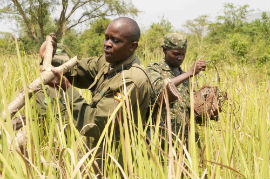
 Ranger removing snare (credit: Dr Andrew Plumptre, Wildlife Conservation Society)
Published in Conservation Biology, the analysis provides spatial maps of illegal activities within Queen Elizabeth National Park, one of Uganda's most important protected areas for elephant conservation.
Analysing 12 years of ranger-collected data, different types of threats were monitored and recorded, including the commercial hunting of large mammals (elephants, hippos and buffalos), the setting of snares for smaller wildlife, harvesting of timber, illegal grazing, the collection of thatch and other products, and illegal fishing.
Revealing that specific poaching locations do not vary significantly from year to year, the results will enable more efficient and effective ranger patrol in the future. Managers can now identify consistent poaching hotspots, even in areas where rangers rarely visit.
Previous research conducted by UWA in 1999 involved rangers collecting geo-referenced information on illegal activities at Murchison Falls National Park, which was then input to a software programme known as MIST. Recording when and where illegal activities occur and how these activities change over time, this system was subsequently extended to all protected areas in Uganda and other countries around the world.
Now, researchers have developed more accurate software known as SMART which is currently being used in Queen Elizabeth Park, allowing more detailed analysis of ranger-collected data than MIST.
Dr Rob Critchlow, Research Associate in the University of York's Department of Biology and lead author on the paper, said: "Ranger-collected data is very biased because rangers target areas where they expect to find illegal activities, making statistical analysis very complicated. It is only in recent years that methods have developed to allow us to make new, more detailed analyses."
Dr Colin Beale, Lecturer in the Department of Biology at York, said: "Our research shows that different threats often occur in very different parts of the park. This means there will now be trade-offs to make in deciding where to invest anti-poaching patrol effort. Managers must decide how important one threat is compared with another, for instance how much money should be used to combat elephant poaching versus snaring of wildlife in general, but we have also identified areas where several types of illegal activity occur but rangers rarely visit."
Dr Andrew Plumptre a WCS scientist who developed the idea for the study, said: "Protected area authorities in Africa typically invest 50-90 percent of their funding in law enforcement to tackle poaching, yet rarely do they measure the impact of their anti-poaching patrolling or evaluate its effectiveness. This new method will provide a tool that will enable that to happen."
Researchers hope future funding will allow the widespread adoption of SMART, enabling managers of national parks across the world to benefit from improved mapping of illegal activities.