Apr 30 2021
A huge storm on par with a Category 2 hurricane was hit the Arctic Ocean in August 2016. The cyclone resulted in the third-lowest sea ice extent that has been recorded so far.
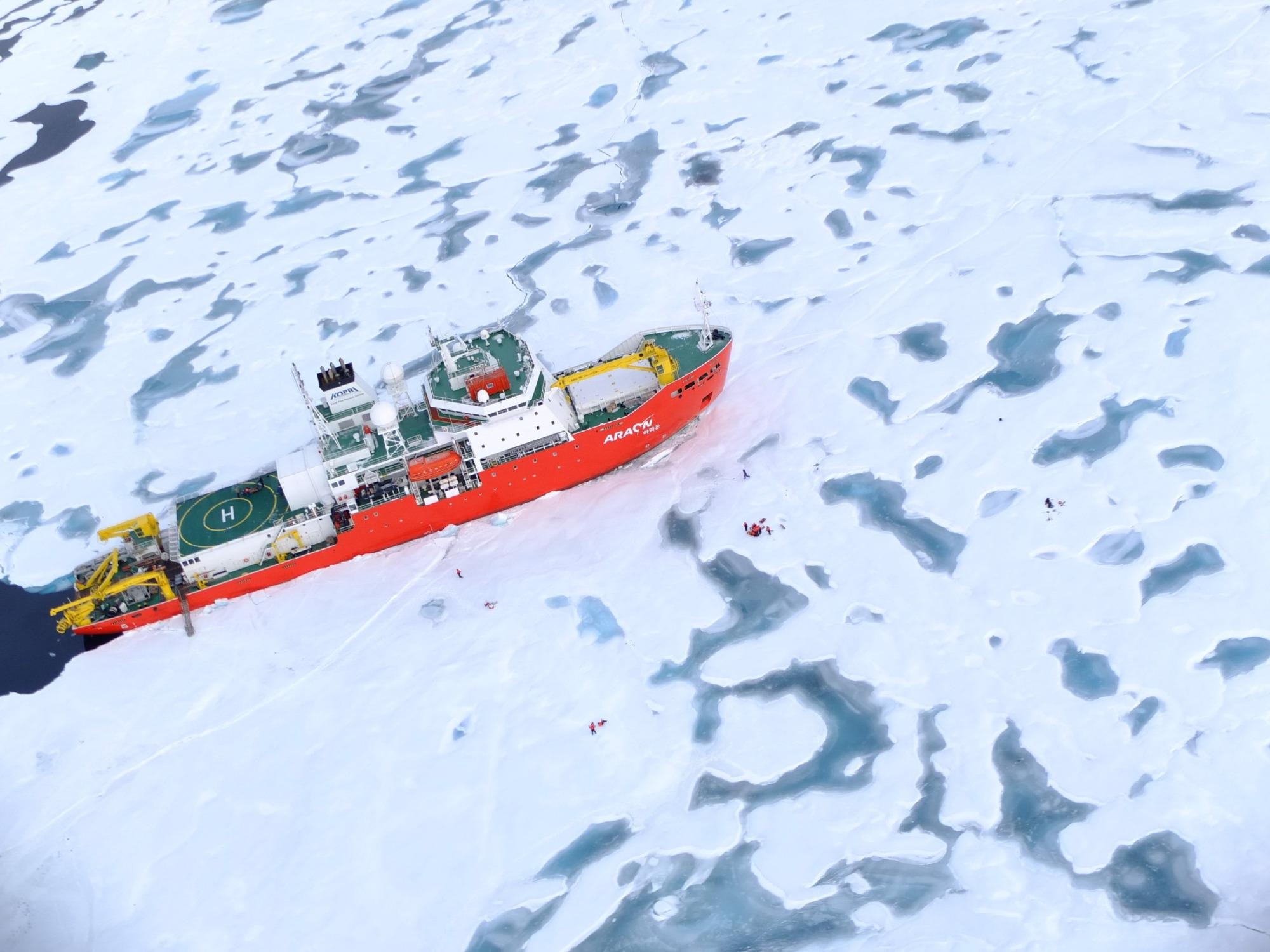
 The Korean icebreaker Araon, which unexpectedly found itself in an Arctic cyclone in 2016, unlocked the key to how these storms wreak havoc on sea ice in the Arctic Ocean. Image Credit: Joo-Hong Kim, Korea Polar Research Institute.
However, the closeness of the Korean icebreaker Araon is what made the Great Arctic Cyclone of 2016 especially attractive to researchers. For the very first time, researchers were able to observe precisely what happens to the ocean and sea ice during a cyclone.
Scientists from the University of Alaska Fairbanks (UAF) together with their international collaborators have recently published a new study demonstrating that sea ice dropped 5.7 times quicker compared to the normal at the time of a storm. Also, they could prove that the quick decline was induced by cyclone-triggered processes inside the ocean.
Generally, when storms come in, they decrease sea ice, but scientists didn’t understand what really caused it.
Xiangdong Zhang, Study Lead Author, International Arctic Research Center, University of Alaska Fairbanks
There was a general hypothesis that the decline of sea ice was only due to atmospheric processes melting ice from above. Zhang and his group proved that this theory is incomplete with the help of “in-situ” observations from directly within the cyclone. The measurements indicated things such as radiation, wind and ocean currents, as well as air and ocean temperature.
It was a touch of good luck as far as science is considered and probably a bit nerve-racking for those aboard because the icebreaker was in a place to capture data from the cyclone. Generally, ships try to evade these storms, but Araon had just sailed into the center of an ice-covered zone and was caught in an ice floe.
As a result of the close position of the ship to the storm, Xiangdong and his colleagues were able to describe that cyclone-related sea ice loss is mainly the result of two physical ocean processes.
First, powerful spinning winds tend to push the surface water to get away from the cyclone. This pulls deeper warm water to the surface. In spite of this warm water upwelling, a small layer of cool water stays directly below the sea ice.
That is the place where a second process becomes an important factor. The powerful cyclone winds serve as a blender by blending the surface water.
Collectively, the surface turbulence and the warm water upwelling warm up the whole upper ocean water column and melt the sea ice from underneath.
Even though the August storm hit for only around 10 days, the effects were lasting.
It’s not just the storm itself. It has lingering effects because of the enhanced ice-albedo feedback.
Xiangdong Zhang, Study Lead Author, International Arctic Research Center, University of Alaska Fairbanks
The expanded patches of open water from the storm tend to absorb more heat, which melts more sea ice, resulting in even more open water. From August 13th to 22nd, the amount of sea ice present in the whole of the Arctic Ocean dropped by 230,000 square miles, an area that is more than twice the size of the state of Arizona.
At present, Xiangdong has been working with a new computer model for the Department of Energy to assess if climate change will result in more Arctic cyclones. Earlier studies have demonstrated that during the last five decades, the intensity and number of cyclones in the Arctic have increased. Few of those storms, such as the biggest Arctic cyclone that has set a record in 2012, have also resulted in the recording of low sea ice extent.
The study was financially supported by the Department of Energy, National Science Foundation, and Korean Polar Research Institute.
Journal Reference:
Peng, L., et al. (2021) Role of Intense Arctic Storm in Accelerating Summer Sea Ice Melt: An In Situ Observational Study. Geophysical Research Letters. doi.org/10.1029/2021GL092714.